Table of Contents
Torquay
Torquay Sundial
Your body becomes the ‘dial’ on this unique piece of art. Stand in the centre of the design and you can tell the time by the shadow cast by your body. The sundial was assembled in the traditional and time-honoured method of mosaic and comprises more than 120,000 glass Tesserae tiles. The sundial represents the traditional dreaming stories of the Indigenous Wathaurong people.
Rocky Point Lookout
Rocky Point is where the waves roll into the Torquay Surf Beach, separating Torquay from Jan Juc. The views are incredible and it gives you a real taste of the rugged coastline that continues for hundreds of kilometres to the west along the Great Ocean Road.
You’ll find beginner surfers and local kids down on the Surf Beach to the east of Rocky Point making the most of the consistent soft and small waves, then look to the west where you’ll see well-seasoned surfers braving the bigger waves at Jan Juc Beach.
Australian National Surfing Museum
Recognised as a significant centre of surf culture the Australian National Surfing Museum is the world’s largest facility dedicated to surfing history and beach culture. It is the only accredited surfing museum making it one of the top places of interest in Torquay. It is also a great choice if you’re looking for things to do in Torquay in winter.
The museum celebrates Australia’s rich beach culture and its significant contribution to the development of surfing around the world for the past 100 years. There are permanent displays featuring an extraordinary collection of surfing artefacts and memorabilia as well as temporary exhibitions.
Torquay Outlet Stores
One of the best things about shopping at Torquay is the Torquay surf outlets. Torquay shopping is a pleasure at Surf City Plaza where you’ll find the latest surf fashions from big-name brands like Rip Curl, Quicksilver, Billabong, Oakley, and Ghanda just to name a few.
Tucked away in Baines Crescent and the surrounding streets these seconds outlets offer some serious discounts and are particularly good for grabbing a deal on a new wetsuit. Stop by any day of the week and snag yourself a bargain.
Anglesea
Located just 10 minutes past Torquay – the start of the Great Ocean Road, Anglesea is a natural playground that the whole family will love.
Coogoorah Park
It is easy to spend several hours in Coogoorah Park which is often more sheltered than the coast. Take a bushwalk around the pathways, fish from the jetties, stop for a barbecue or rest while the children play in the playground which includes a wooden ship inspired by the ‘Inverlochy’, wrecked off the coast in 1902.
Soapy Rock
Soapy Rocks is a huge red slab of Sandstone that form cliffs just off the shore and stick out of the beach in different areas, just a short walk to the south of the Anglesea beach and river mouth.
Most of the time, the rocks on the shore and at the top of the bluff behind the beach are super slippery and that’s why it’s called ‘Soapy Rock’ or sometimes ‘Slippery Rocks’.
There’s a mostly sandy 700-metre long beach below the long cliff with waves at either end that is decent for surfing.
Loveridge Lookout
For amazing 270 degree views over Anglesea, the river, Point Roadknight to Aireys Inlet, Loveridge Lookout is tops. The lookout was built in 1938 as a memorial to James Loveridge. His widow Bertha selected the site – his favourite vantage point to watch the ocean.
The Anglesea Lookout reserve is nationally important in maintaining indigenous flora and fauna biodiversity. This small remnant of coastal heathland is extremely rich in plant species. Windswept low-growing grasses, herbs and small shrubs form a blanket cover over the landscape. In spring, look for beautiful orchids beside the tracks and in the more open areas.
Point Addis Marine National Park
The Point Addis Marine National Park features spectacular scenery with wide sandy beaches, crumbling limestone and sandstone cliffs, rocky platforms and copious small rocky reefs. The coastline is exposed to intense wave action from the southern ocean, shaping this rugged coastline.
Visitors exploring the marine environment within this park may enjoy exploring the limestone reefs with abundant rock pools filled with marine life. The subtidal waters are recognised as supporting a wide range of fish and algae species as well as seals, dolphins, brilliantly coloured sponge gardens and extensive rhodolith beds.
Aireys Inlet
Eagles Nest Fine Art Gallery
For those who are interested in fine arts, this is an excellent stopping off point for you on your journey down the great ocean road.
The gallery is housed in a stunning purpose-built building, they exhibit an ongoing display of local and regional artists’ artwork, plus bi-monthly exhibitions. The gallery shows off a range of exhibit artwork in many mediums, including painting, glass art, sculpture, jewellery, prints, cards, etc.
Split Point Lighthouse
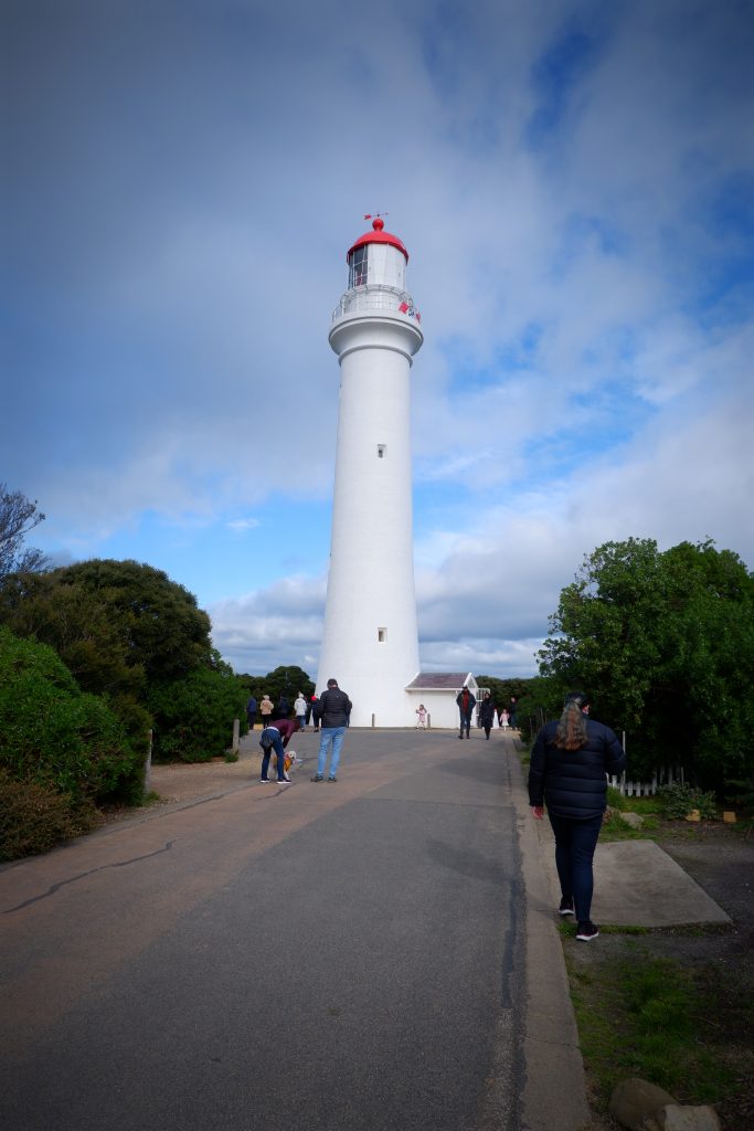
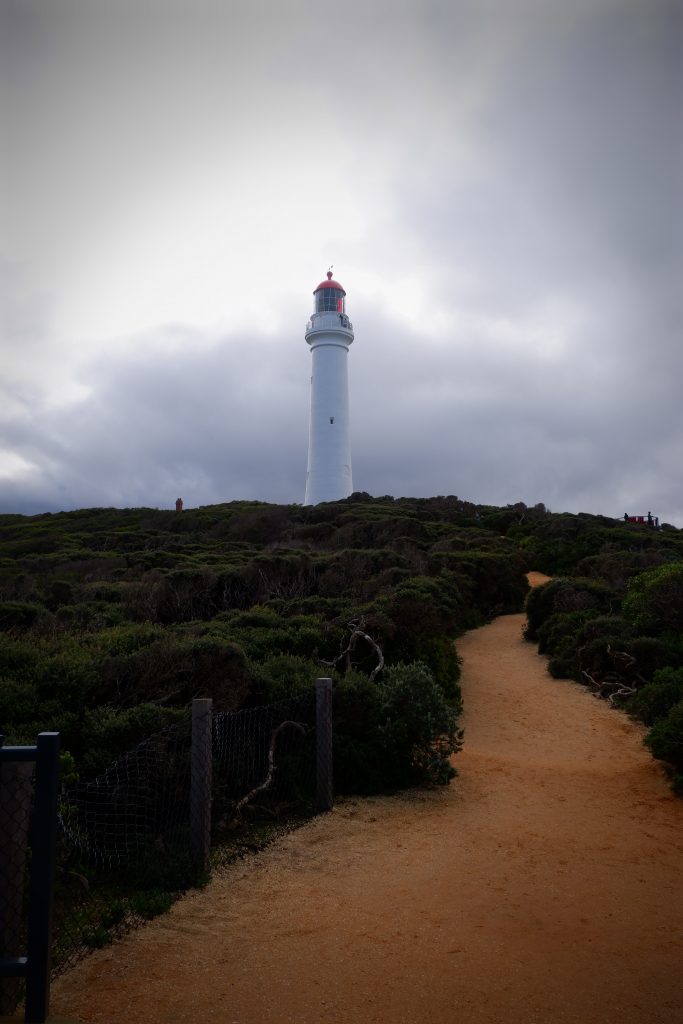
Today it is famous for its role in the TV series ‘Round the Twist’ and you might spot a pod of dolphins or whales from the top balcony. The lighthouse is open daily for tours, weather permitting.
Originally called Eagles Nest Point, the lighthouse was constructed in 1891. For 27 years, three lighthouse keepers worked at this remote location, ensuring the light was operating well and communicating with ships via a number of code systems. The lighthouse still has its original construction with a wonderful staircase and timber fittings. The lantern still operates having had more than three different light sources over its history. The tower was converted to automatic operation in 1919. It is still a vital working lighthouse for vessels navigating the treacherous waters of Bass Strait and still operates every night by an automated system.
Eagle Rock Marine Sanctuary
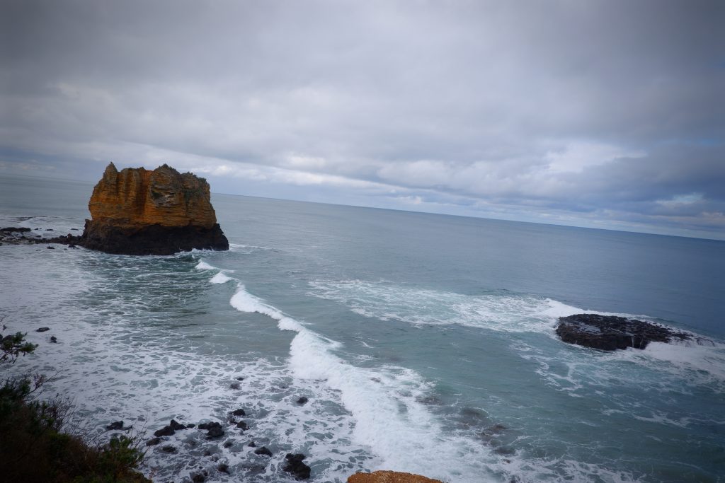
Located only a short walk from the Aireys Inlet lighthouse, it makes it a perfect stop to knock off two things at once. The lookout provides a perfect view of the sanctuary as well as Eagle Rock and Table Rock.
This park protects 17 hectares of ocean waters and projects about 300 metres offshore. Composed of both hard basalt and rubbly limestone, the cliffs are full of caves and ledges. The shore is covered with boulders and offshore there are two large rocks: Eagle Rock and Table Rock. Table Rock has been levelled by incessant waves whereas Eagle Rock is a tall volcanic stack capped by limestone.
Reef Lookout
Access to the lookout is very easy from the parking area. From here depending on the weather you are able to have great photo opportunities. While the actual lookout is no more than a wooden platform, it serves its purpose well with extensive, uninterrupted views in all directions.
Lorne
Lorne Pier
The first Lorne pier was built in 1879 to serve the logging industry. The pier is best known for the Pier to Pub Lorne swimming event, dating back to the 1880s.
The new pier has a vintage feel with a traditional boardwalk running its full length. However, instead of the usual pier ‘L’ shape, Lorne Pier boasts a unique curve.
Lorne’s new pier won the approval of the community and also received an Engineering Excellence award in 2007. A short section of the old pier was left as a historical reminder, and the old crane that initiated the whole project sits onshore, patiently waiting to go in its final resting place.
Sheoak Falls
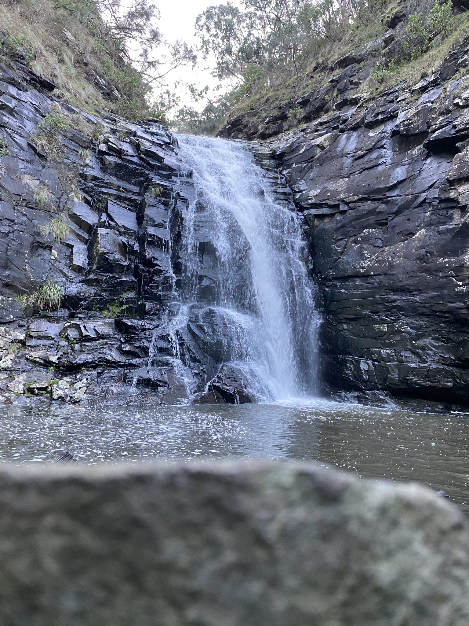
Sheoak Falls is a picturesque waterfall just 6 km from Lorne. The walk, which begins from the mouth of the Sheoak River or the carpark, is well signposted. The falls are a 15-minute walk from the road with the track climbing to a boardwalk complete with a seat to enjoy the brilliant ocean views before descending toward the Sheoak River. Follow the track to the base of the falls for views of the 15m cascade and deep pool.
Erskine Falls
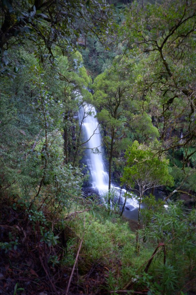

Erskine Falls is only a 9-kilometre drive from Lorne. Take in the cascading waterfall from the two lookouts. The upper lookout is an easy five-minute walk from the car park. The lower lookout is a more strenuous walk, down some 240 steps to the base of the falls. They each have their own rewards. For the more adventurous, try out the 7.5km Erskine River Track to the Straw Falls and Splitter Falls that will simply take your breath away.
Teddys Lookout
A short drive to the top end of George Street at the back of Lorne is the scenic spot known as Teddys Lookout. A newly constructed walkway takes you to the viewing platform where you have breathtaking, sweeping, coastal views of the surf breaking into the mouth of the Saint George River. On the lower platform to the right, views change to mountainous peaks and the Saint George river winding itself into fern-covered valleys and gorges. Teddys Lookout has amazing views of both Bass Straight and The Great Ocean Road.
Live Wire Park
Live Wire Park is powered by nature, nestled among the towering Otway treetops. One of the great things about Live Wire Park is that it’s Australia’s first completely off-grid elevated adventure park. Fuelled by solar power, paired with all water being collected, used and treated on-site, makes Live Wire Park a sustainable business.
Apollo Bay
Stop into the beautiful village of Apollo Bay located at the foothills of the Otways. Hit the waters of the southern ocean, wander the coast and explore petrified rainforests full of waterfalls, ferns and crystal clear streams. Adventure over for the day; settle in to enjoy the fruits of the sea caught by local fishermen.
Carisbrook Falls
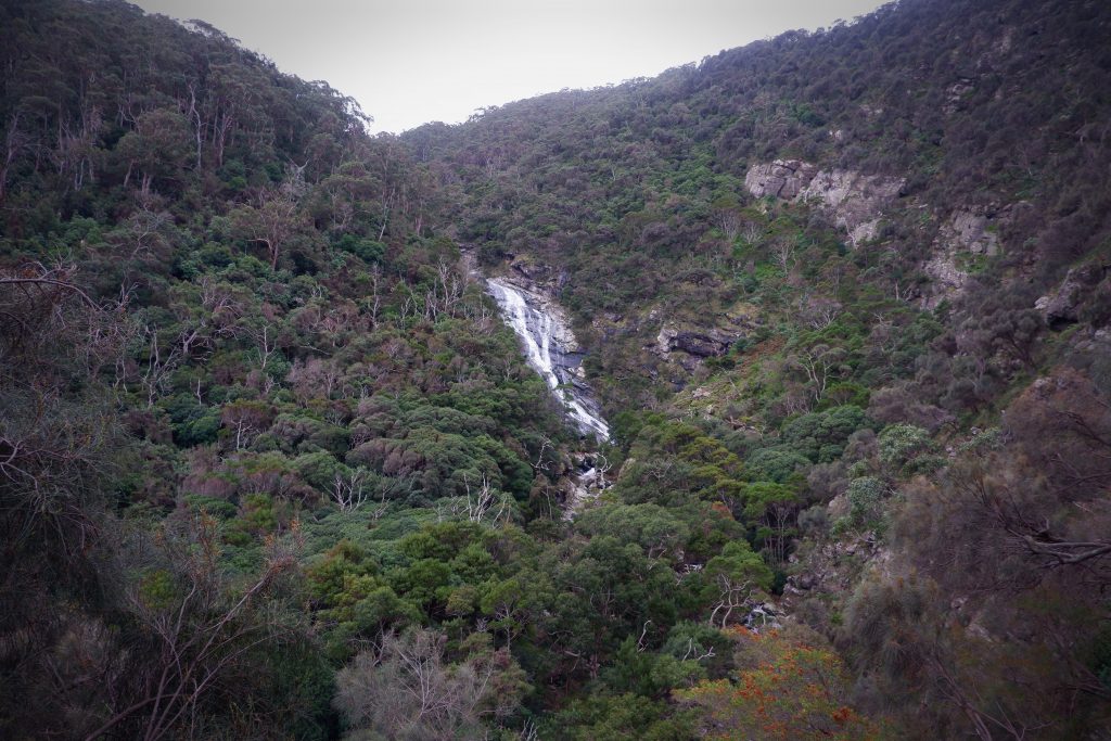
Carisbrook Falls is roughly a 20-minute drive away from Apollo Bay. Easy accessible from the main highway, Carisbrook Falls is located at Otway National Park. The stunning waterfall can be viewed from a distance only.
The track to the waterfall viewing point is a short 300m uphill walk or 600m return. It should take you about 30 minutes to return if walking at a leisurely pace. When you arrive at the lookout across this ravine, you will be able to gaze upon the stunning Carisbrook Falls. The amount of water flowing over the falls is always weather d pendent.
Mariners Lookout
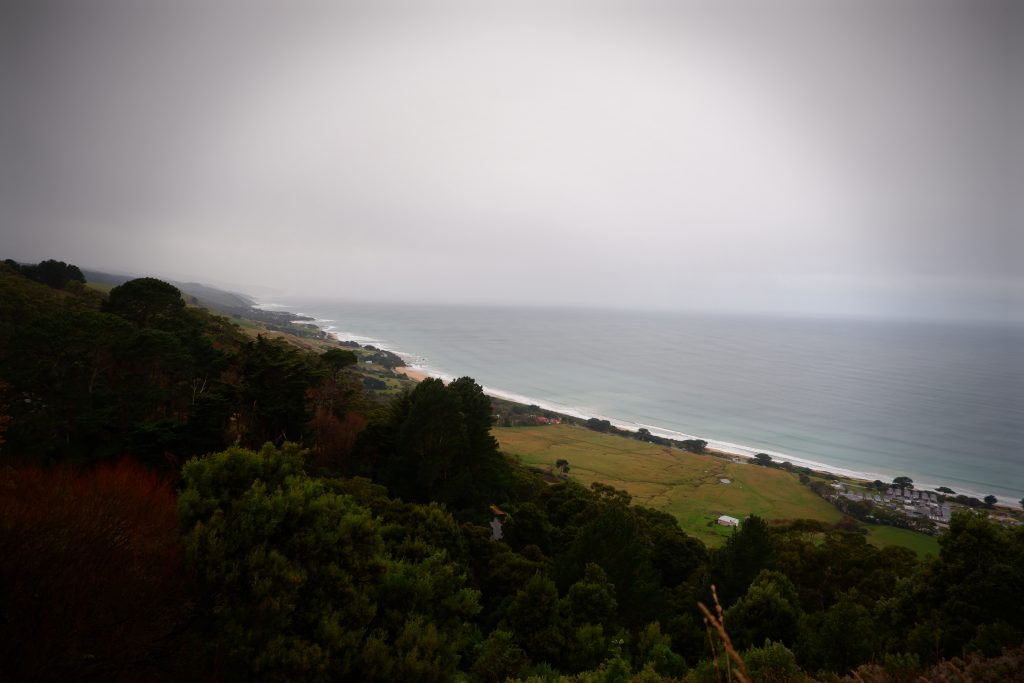
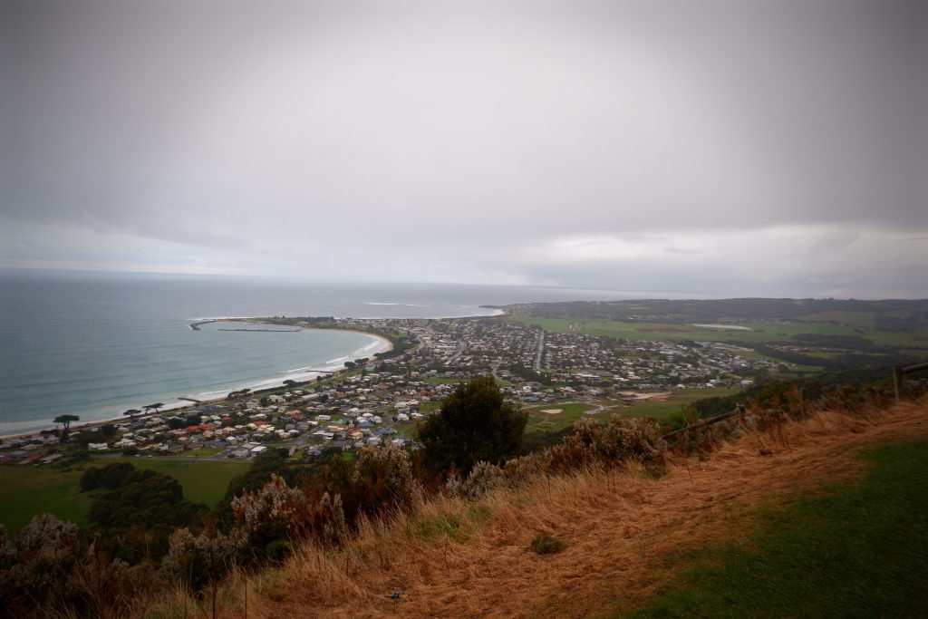
An easy 10-minute walk from the carpark is rewarded with spectacular ocean, beach, hinterland and town view. If you’re feeling more energetic, walk about 1.5 kilometres north from Apollo Bay along the beach or Great Ocean Road, then climb a steep hill along a surfaced road for another 1.5 kilometres to the lookout track. If taking this route make sure to be on the lookout for passing traffic
Marriners Lookout is a popular take-off point for hang gliders. With the right conditions, you may see someone take off.
Otway National Park
Great Otway National Park stretches from Torquay, along the world-famous Great Ocean Road and up through the Otways hinterland. Discover windswept coastlines and breathtaking waterfalls in tall mountain forests, walk the iconic Great Ocean Walk, immerse yourself in the Otway Lightstation’s history, or surf some of the best breaks in Australia.
Maits Rest
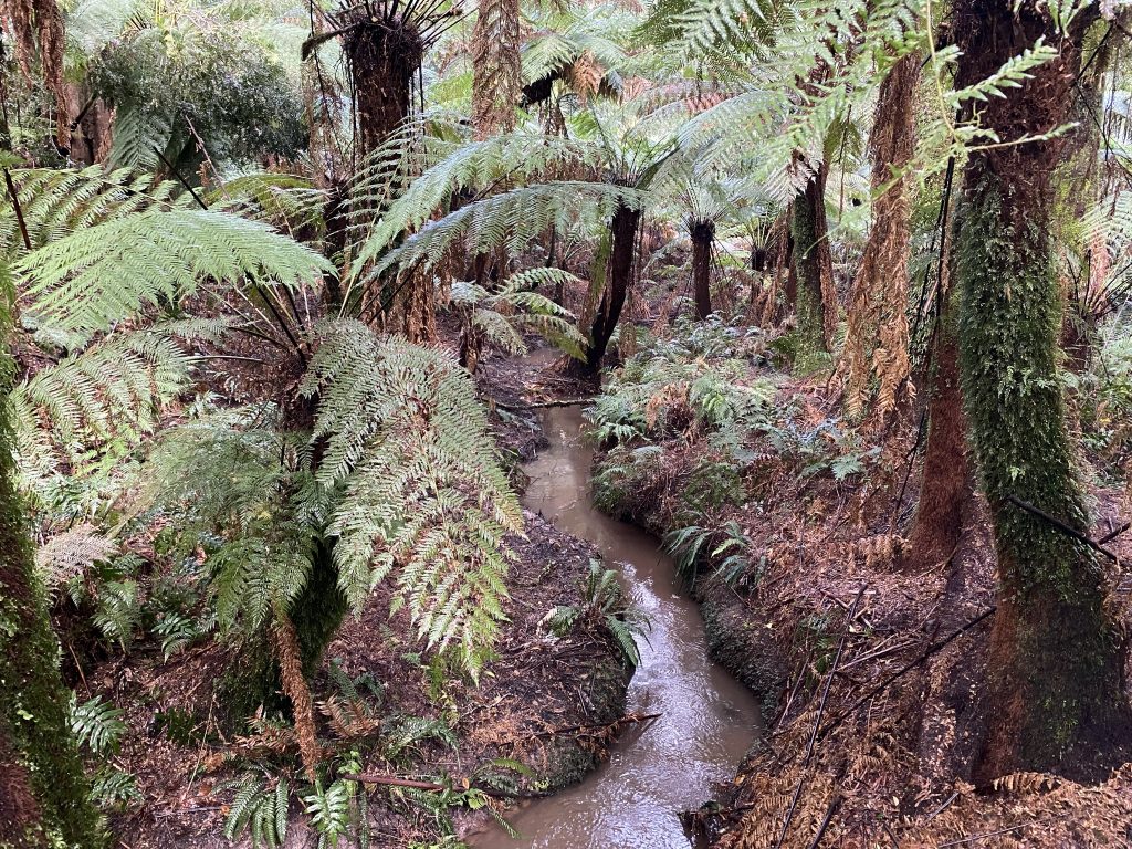

Maits Rest is a self-guided rainforest boardwalk through beautiful fern gardens and giant rainforest trees that are as old as 300 years. A wooden boardwalk has been built over the tree-fern gullies and moss-covered roots of ancient rainforest trees, protecting the delicate ecosystem while providing visitors with unique views of the forest. If you are lucky enough you could be able to see some of the native animal life. The whole walk will only take around 30 minutes at a leisurely pace and is only filled with relatively gentle slopes.
Otway Fly
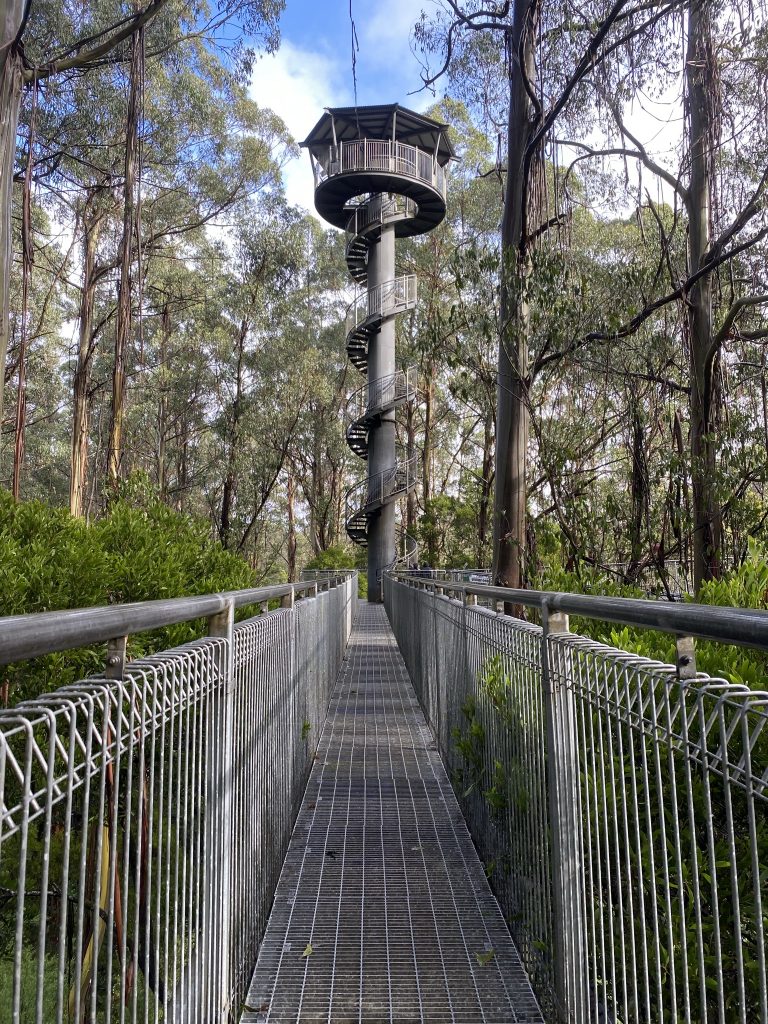
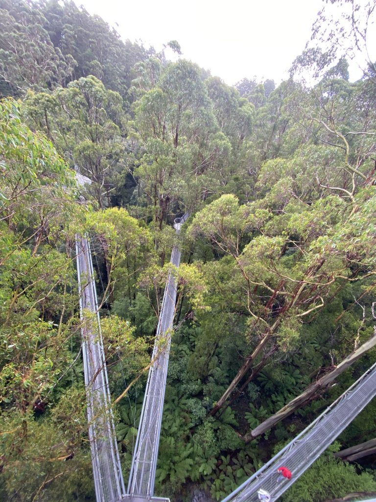
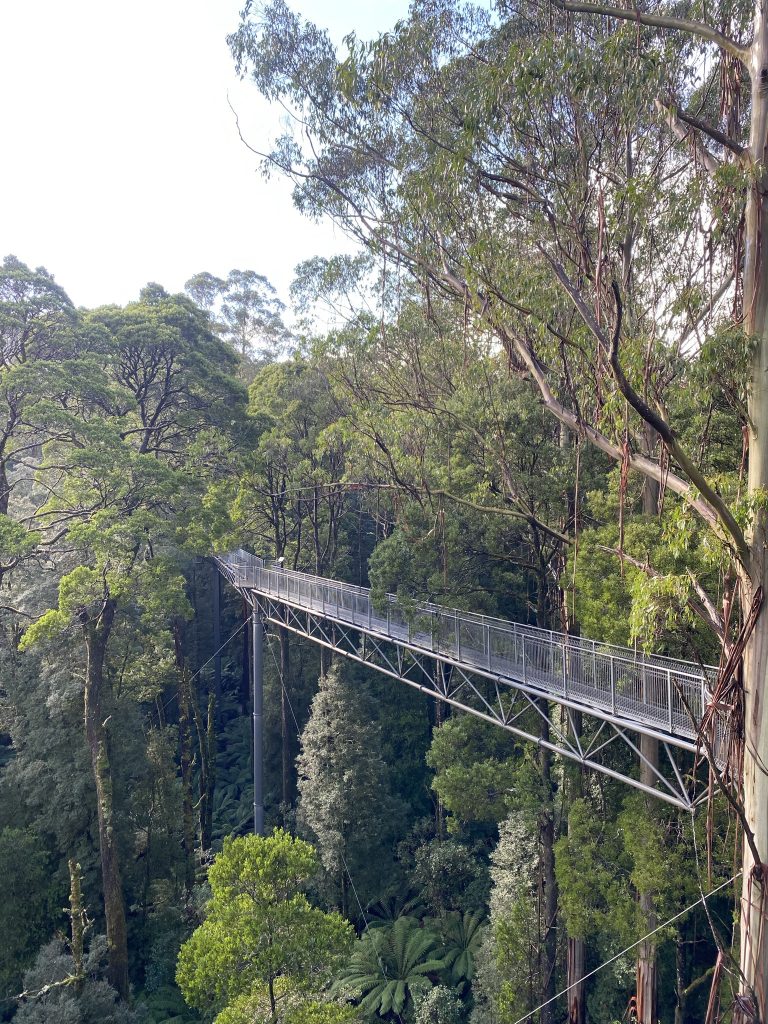
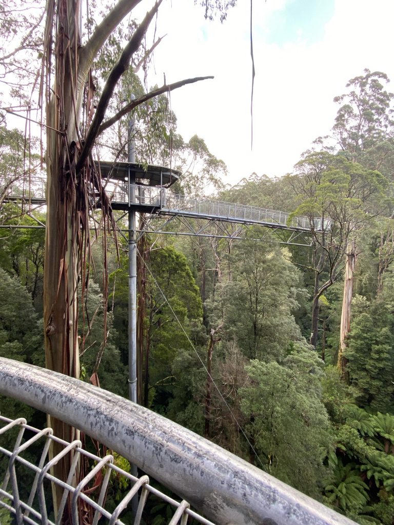
Otway Fly Treetop Adventures is located only 20 minutes from the Great Ocean Road. They are one of five canopy walkways in Australia and the only one in Victoria! Experience a breathtaking birds-eye-view of the magnificent Otway Ranges from their 25 metre-high elevated walkway or fly 30 metres high from tree to tree on their Zipline Tour.
Otway Lightstation
Cape Otway Lighthouse is the oldest surviving lighthouse on mainland Australia and is considered the most significant. This leading attraction on the Great Ocean Road is a must for all visitors. It was built in 1848, the lighthouse was known as the ‘Beacon of Hope,’ sits 90 metres above the pristine ocean of Bass Strait.
The light station was decommissioned in January 1994 after being the longest continuous operating light on the Australian mainland. It has been replaced by a low powered solar light in front of the original tower, its light characteristic is three white flashes every 18 seconds.
Port Campbell
Port Campbell National Park
The Port Campbell National Park is part of an Aboriginal cultural land Australia’s Campbell National Park is also home to a You’llthat carve out a niche on this inhospitable coastline. At dusk, they come home from their feeding grounds out at sea. Look down at the Twelve Apostles or London Bridge and you can see Little Penguins. Or check out the natural wonder of thousands of Short-tailed Shearwaters returning to roost on Muttonbird Island near Loch Ard Gorge. Whales are also a common sight along the coast and Port Campbell township is a good lookout to sp t them from.
12 Apostles
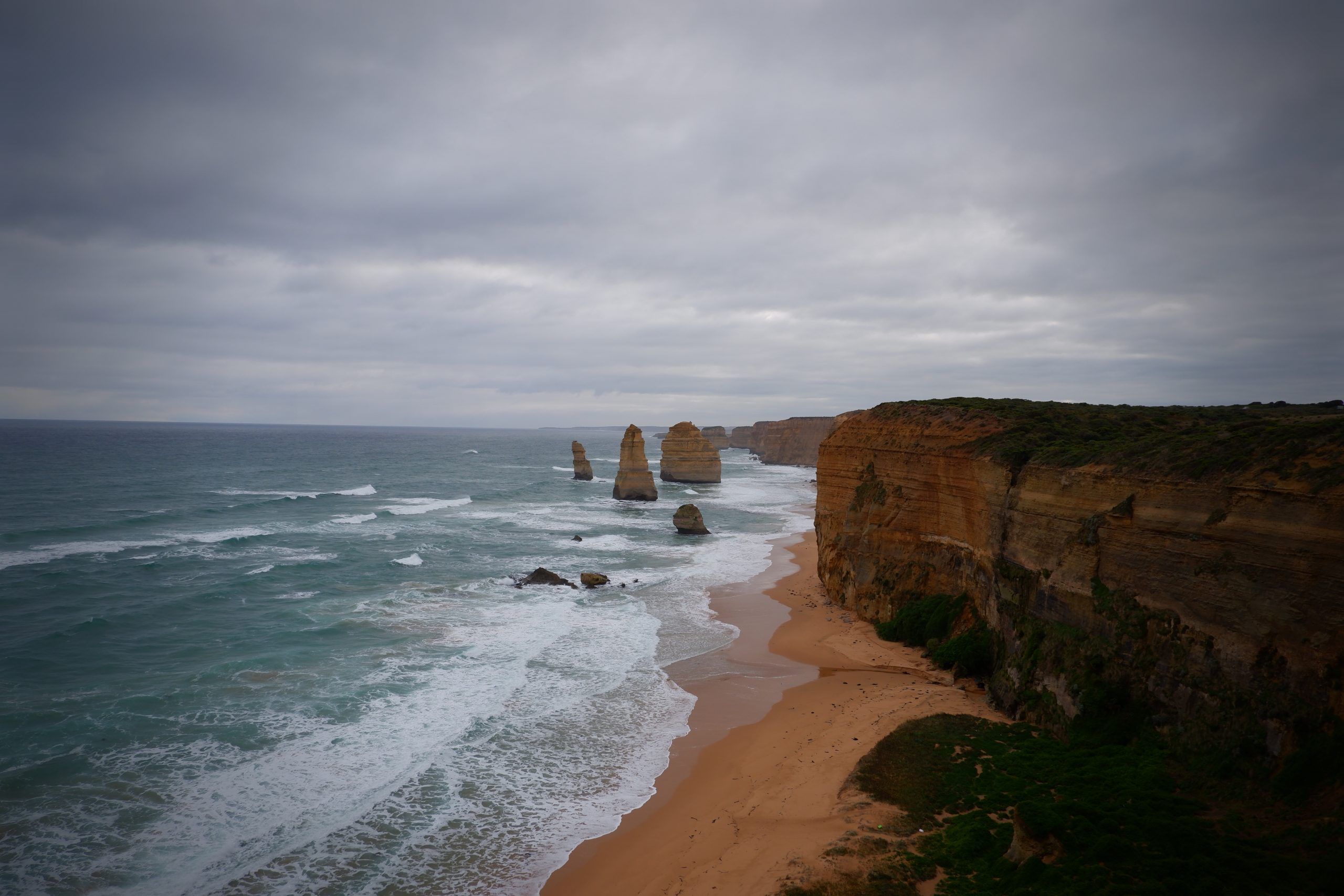

The Twelve Apostles is one of Australia’s most popular attractions all year round. You’ll be lucky to have the lookouts to yourself, but there are likely to be much fewer people if you arrive earlier or later in the day.
If you time it right, you can view the rock stacks in their best light – at sunset. In the summer, the sets further out to sea, while in the winter, the sun sets closer to shore. If the clouds stay away, you’re guaranteed memorable photographs.
The Twelve Apostles can be seen as seven limestone rock stacks. Six of them are visible in the classic view enjoyed by millions of people every year, while the seven h is located several metres away from the corner of the main viewing platform.
Loch Ard Gorge
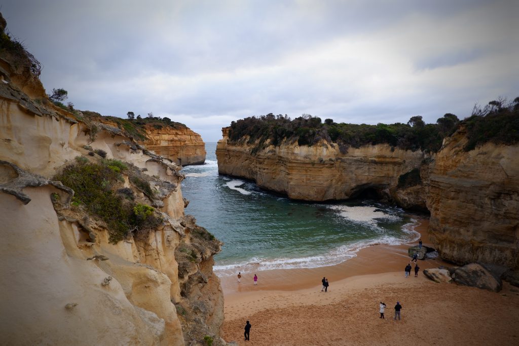
Loch Ard Gorge is only a few minutes drive down the Great Ocean Road from the world-famous Twelve Apostles. Loch Ard Gorge was the scene of the Shipwreck Coast’s most famous shipping disaster. The Loch Ard ran aground, crashing into Mutton Bird Island in 1878. The only two survivors Tom Pearce and Eva Carmichael managed to drag themselves to the safety of the beach inside Loch Ard Gorge.
There is a variety of different walks that one could take if they have the time. Each of them goes to a different section of the coast, some being further and some shorter. if you have the time each of them is worth the visit as you get spectacular views from every viewpoint.
London Bridge
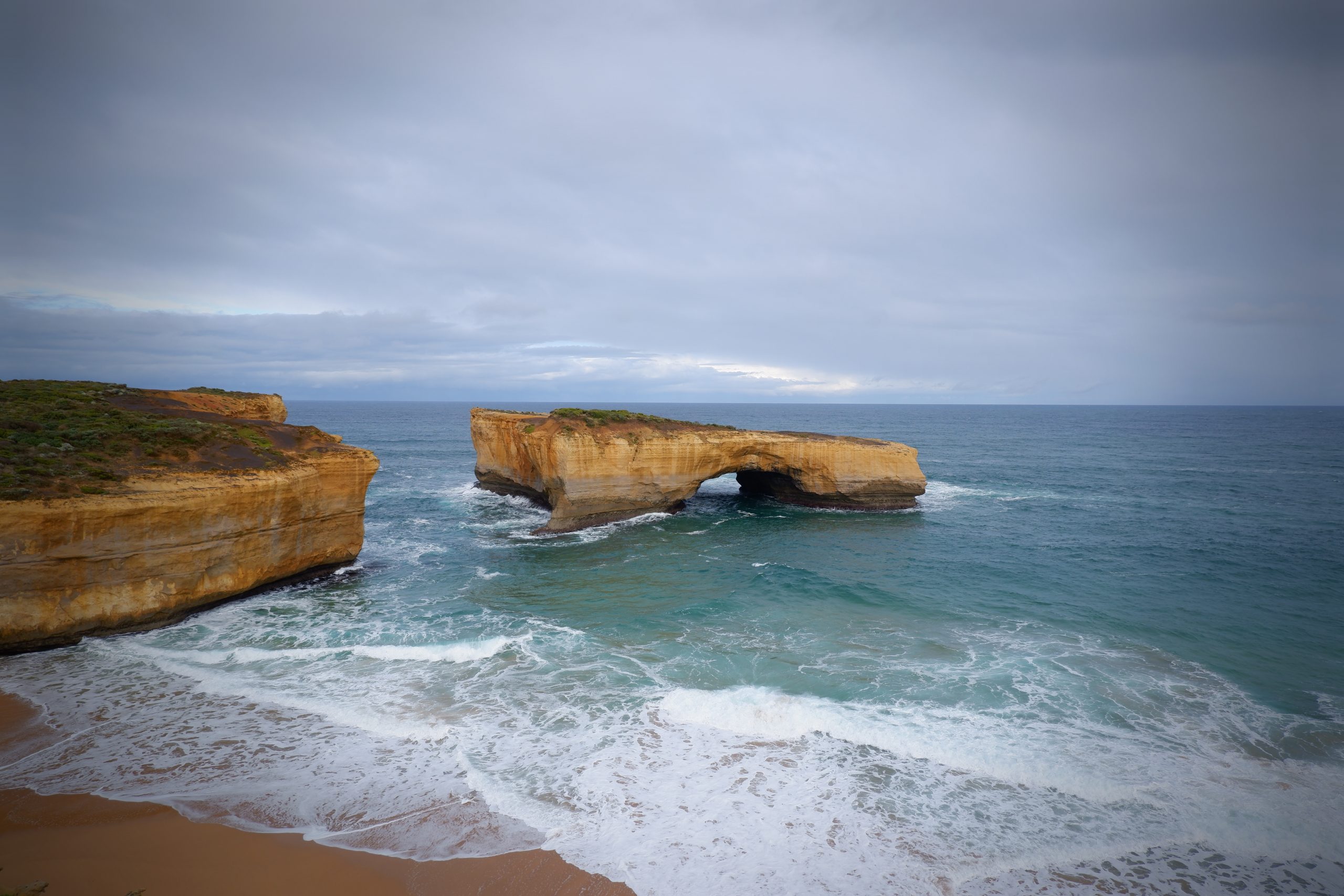
A short drive along the Great Ocean Road from Port Campbell lies London Bridge a natural archway and tunnel, London Bridge collapsed on 15 January 1990 and became an isolated arch no longer connected to the mainland.
Come to the lookout for the views or at dusk to spot the adorable Little Penguins coming to the protected beach below.
Warrnambool
Situated on the Princes Highway, Warrnambool (Allansford) marks the western end of the Great Ocean Road and the southern end of the Hopkins Highway.
Flagstaff Hill Maritime Museum and Village
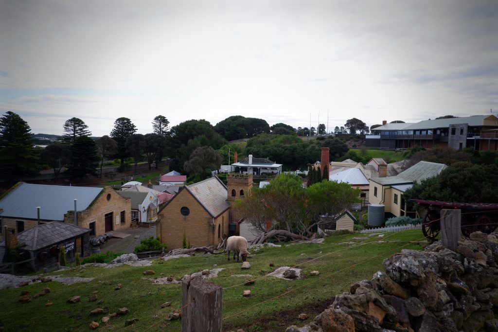

The Maritime Village is both a historical village that displays the life of a 19th-century port and town and holder of Victoria’s largest maritime shipwreck collection. It occupies a beautiful site, tumbling down the bluff towards Lady Bay. You can explore the village area that has over 40 buildings and vessels spread over 10 hectares.
Logans Beach Whale Watching Platform
From the sandy dunes of Logan’s Beach, you have the perfect vantage point for spotting the whales. This is where Victoria’s Southern Right Whale nursery is located, so you have a high chance of seeing these huge creatures as they begin their migration.
Almost every year between June and September, female Southern Right whales come to the waters of Warrnambool’s Logans Beach to calve. From the beach, you can easily come within 100-metres of the mammals, as they frolic around the shore, there is also a specially constructed viewing platform that offers incredible views across the ocean and out into the nursery.
Tower Hill Wildlife Reserve
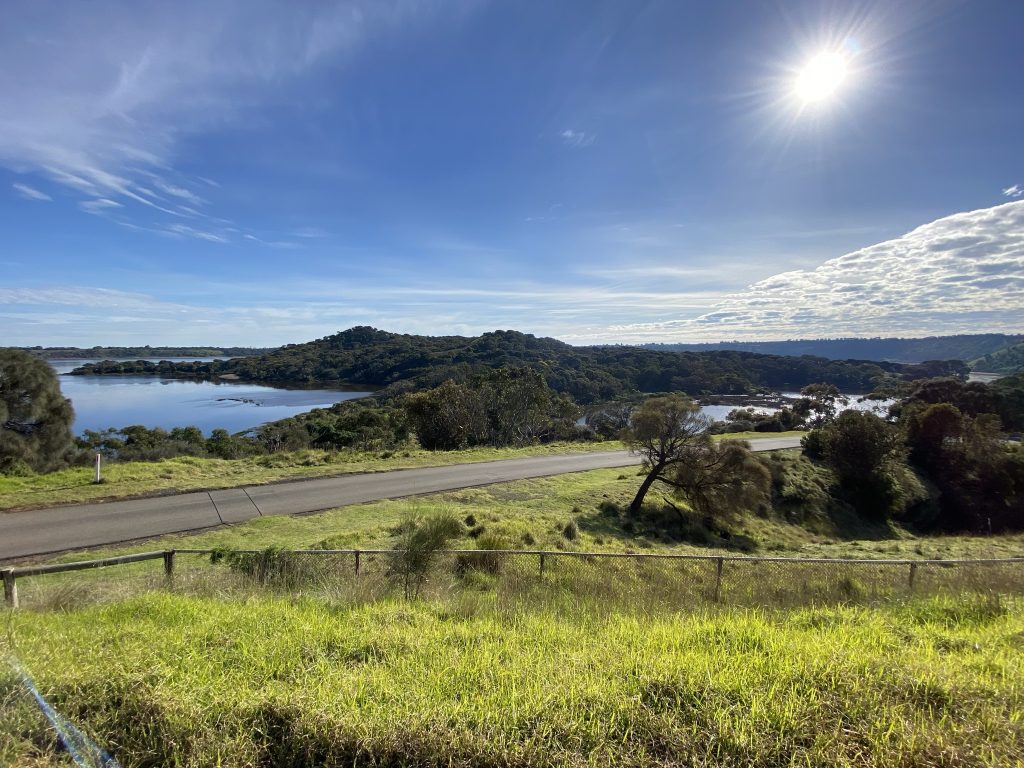
Tower Hill Wildlife Reserve is a crater lake created by a volcano that last erupted some 30,000 years ago. You can meet koalas, emus, kangaroos and many species of waterbirds roaming freely in Tower Hill Wildlife Reserve.
The reserve was declared Victoria’s first National Park in 1892, Tower Hill is the ideal place for visitors to experience the Australian bush
Port Fairy
Port Fairy is a historic fishing town located on Victoria’s far southwest coast on the Moyne River, between Portland and Warrnambool.
Port Fairy Fishermans Wharf
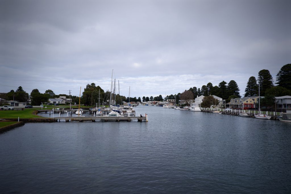
The Fishermans Wharf area along the river is lined with boats and fishing craft, and good views of river activity can be enjoyed from the footbridge over the Moyne. Another good viewing spot is from the historic fortifications at Battery Hill, located at the southern end of Griffiths Street.
Griffiths Island
Griffiths Island is a sanctuary for plants, birds and animals. The island is about 1.5 kilometres long a d 0.8 kilometres wide at its widest point. Originally a cluster of three separate islands – Goat, Rabbit and Griffiths – harbour works have consolidated them into a single island that protects the mouth of the Moyne and shelters Port Fairy Bay.
Griffiths Island Lighthouse
Since 1859, the Griffiths Island Lighthouse has faithfully guided ships into the security of the historic Port Fairy located on the Moyne River. It is located at the end of a very scenic 400 metres walk across the island.
The last lighthouse keeper that lived on the island was there from 1929 till 1954. There was one more lightkeeper, for a short time, before the light was automated.
Battery Hill
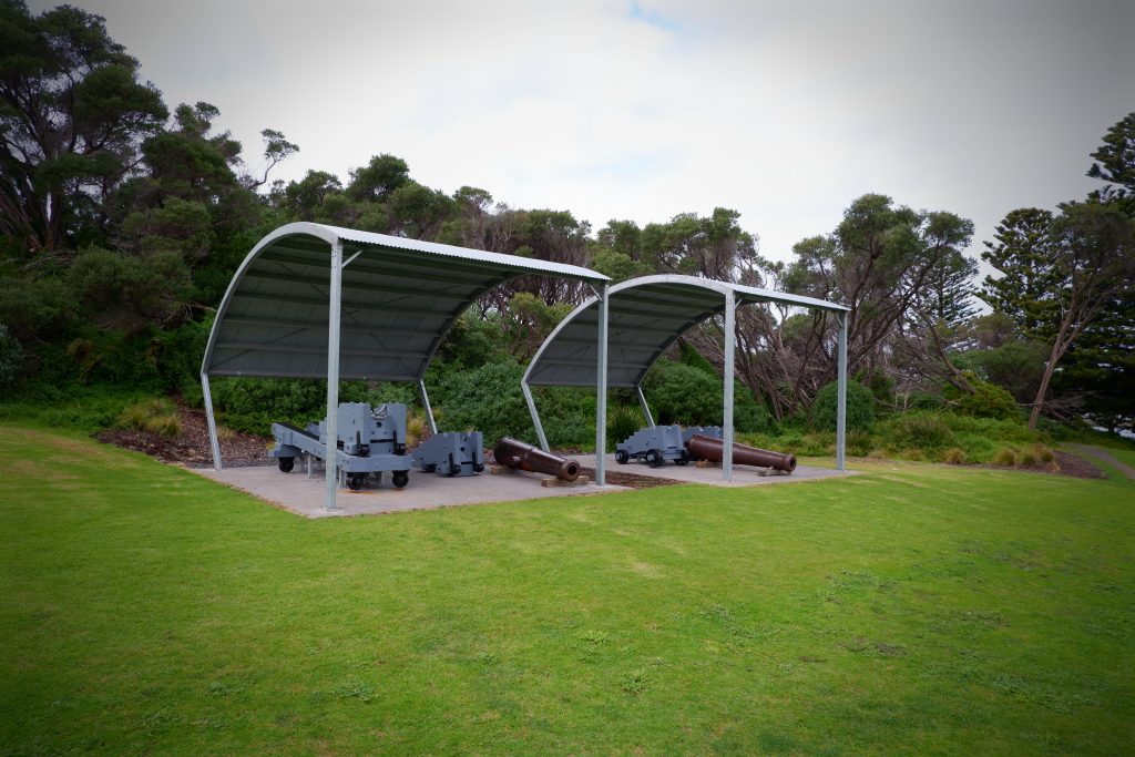
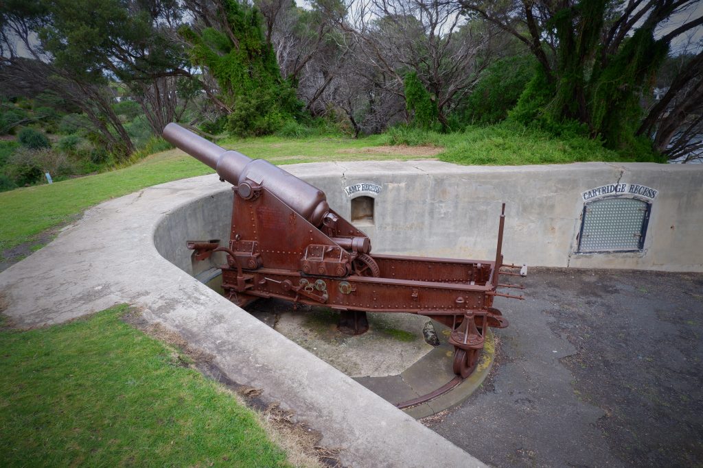
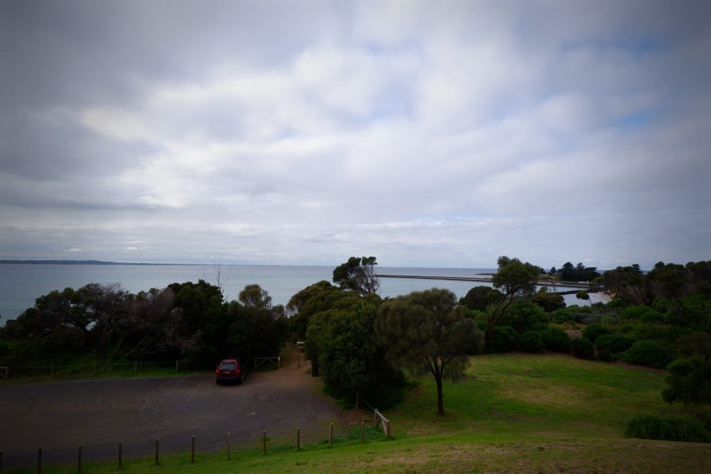

Battery Hill is worthy of exploration, with cannons and fortifications positioned here in 1887 to protect the town from the then perceived threat of Russian warships. Keep an eye out for the black wallabies that reside here. It was originally used as a flagstaff, so the commanding views don’t disappoint.
Portland
Petrified Forest
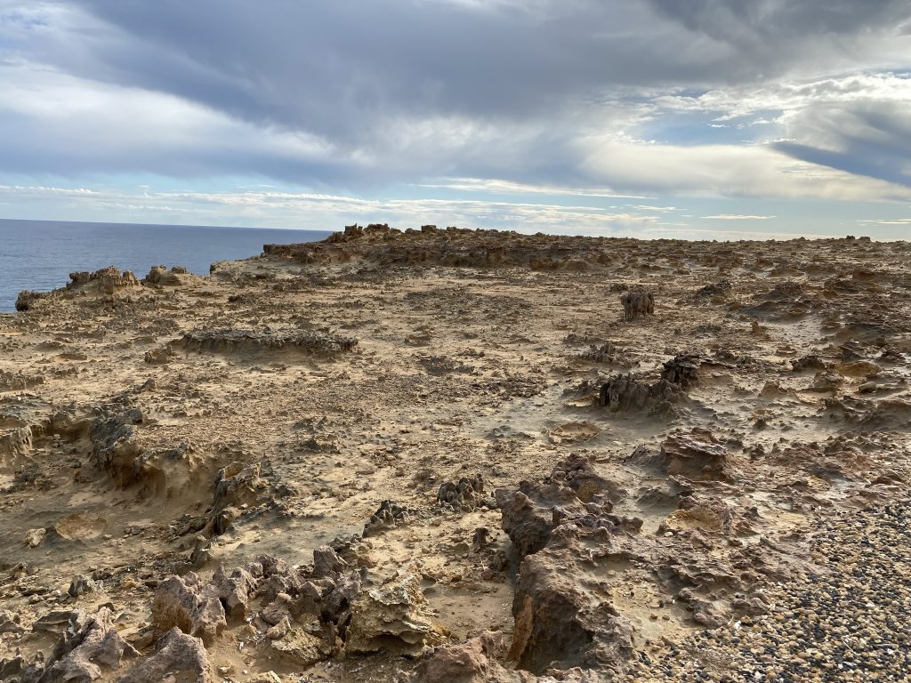
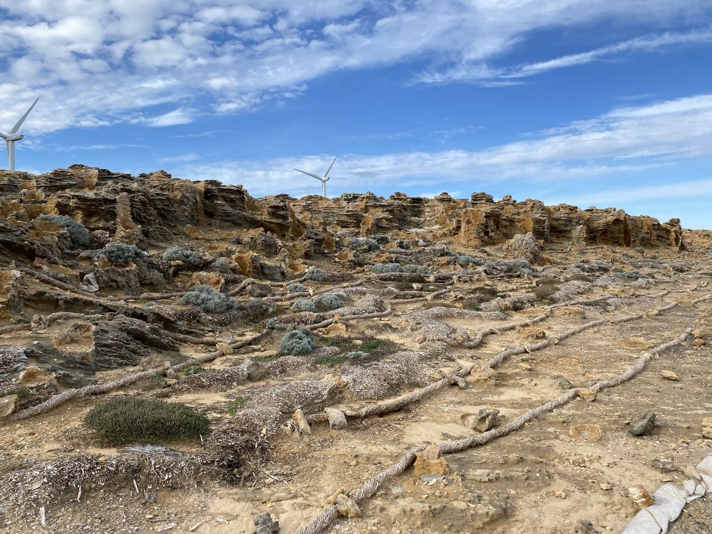
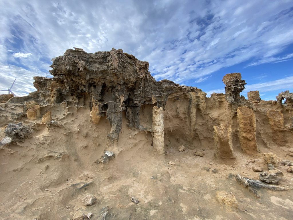
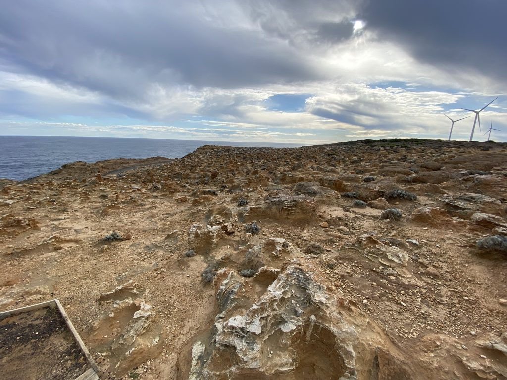
This area is called the petrified forest from an early theory that advancing sand engulfed an ancient forest of coastal trees that once covered the sea cliff, petrifying them for all time. The formation is actually a collection of hollow tubes of limestone called “solution pipes”, which have been eroded by millions of years of rainfall.
The Petrified Forest is easily accessible from the carpark at the end of Blowholes Road, Cape Bridgewater.
Bridgewater Blowhole
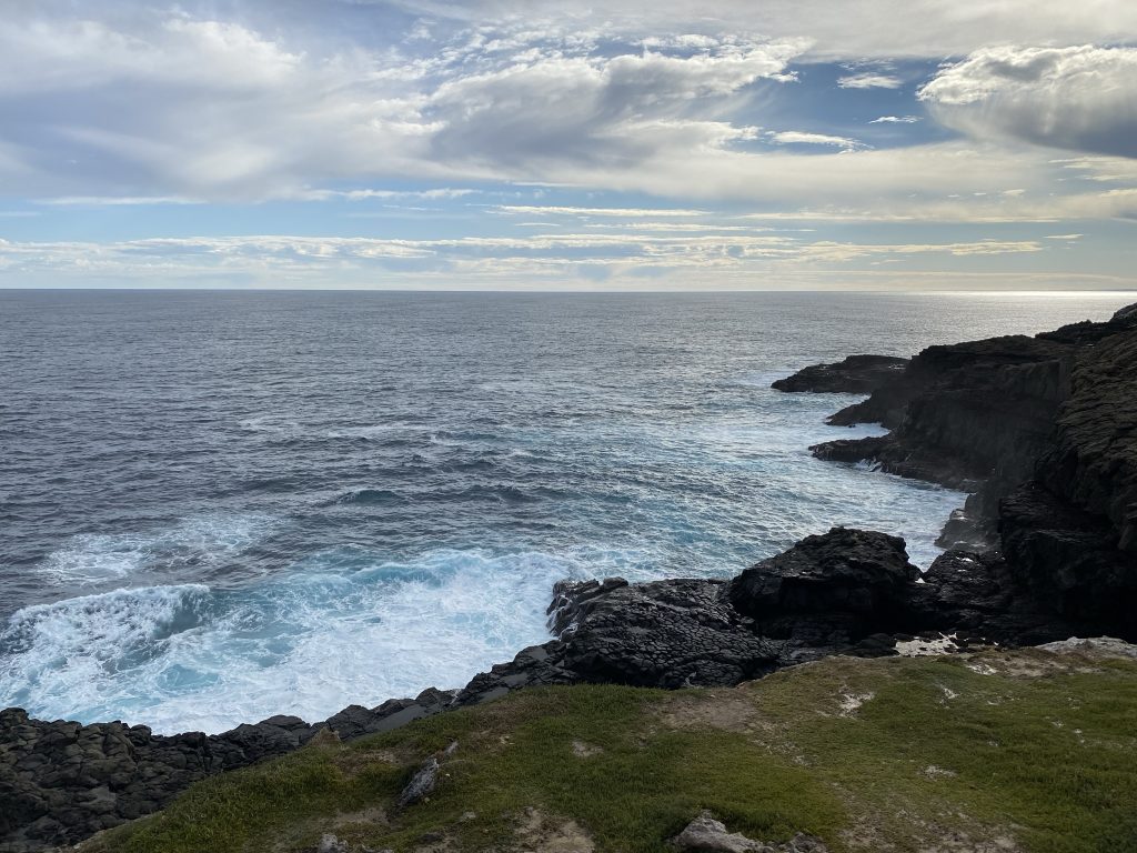
The blowholes are rock tunnels that have been etched out of the volcanic rock by the waves. During rough seas, they spout spray high into the air.
The walk is 100 metres in length, and visitors should heed the warning signs regarding the unpredictable nature of the ocean waves in this area.
Cable Trams

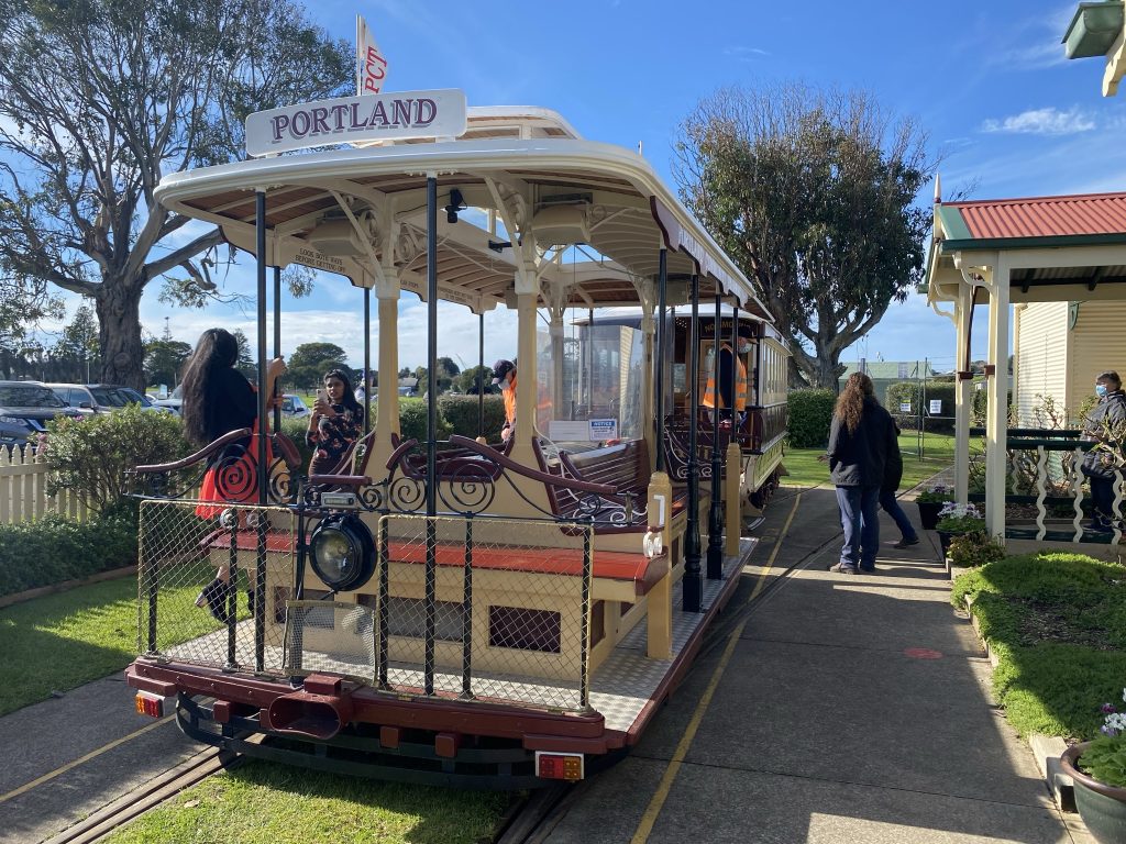
The cable tram attraction opened on the 2nd of March 2002. Two of the trams are copies of Melbourne cable trams which ran from 1885 to 1940. The entire track is a 7.4km return, travelling along Portland’s spectacular foreshore; the Portland Cable Tram is a must-do for any visitor to the town.
You are able to hop on and off at your leisure to visit attractions including the Portland Maritime Discovery Centre, Powerhouse Museum, World War II Memorial lookout, Portland Botanic gardens and Cable Tram museum, which is home to model trains as well as the largest private gemstone collection in the southern hemisphere.
Maritime Discovery Centre

Victoria’s far southwest has a rich maritime history. Portland is the site of the state’s first commercial port and once-thriving whaling industry. The museum showcases this illustrious history in the form of many artefacts and testimonials of past peoples.
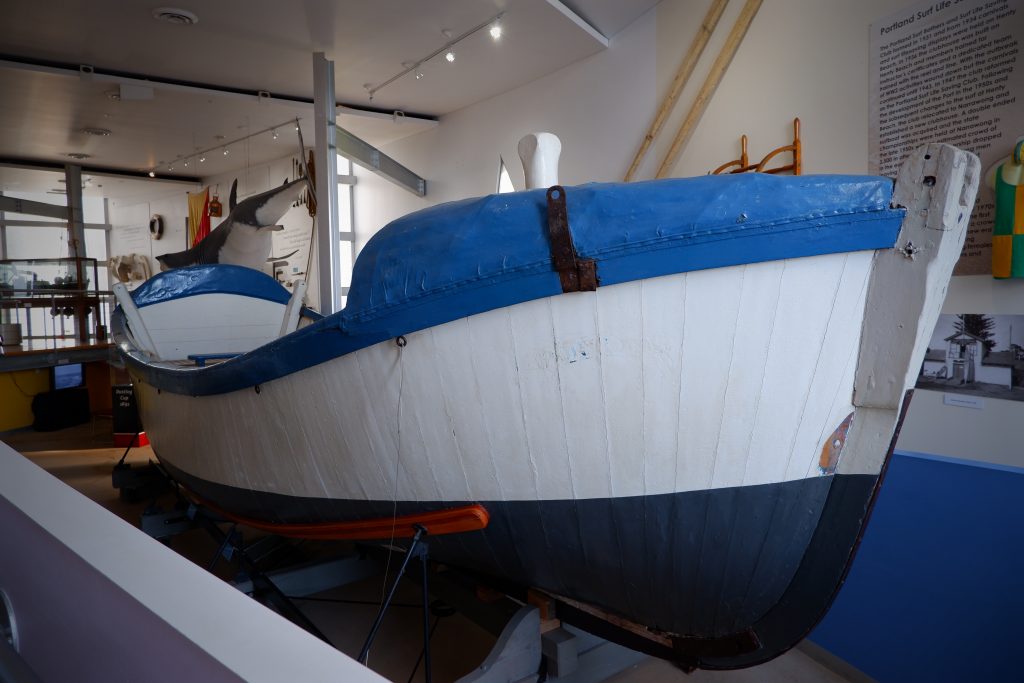

Upon your entry into the museum, you are greeted by a 14-metre Sperm Whale skeleton, which you are able to get up close and personal with. The museum’s centre point is the historic Portland Lifeboat, one of the oldest of its type in the world and renowned for its role in rescuing survivors from the Admella wreck in 1859. It is one of the oldest surviving wooden boats in Australia.
Cape Nelson Lighthouse
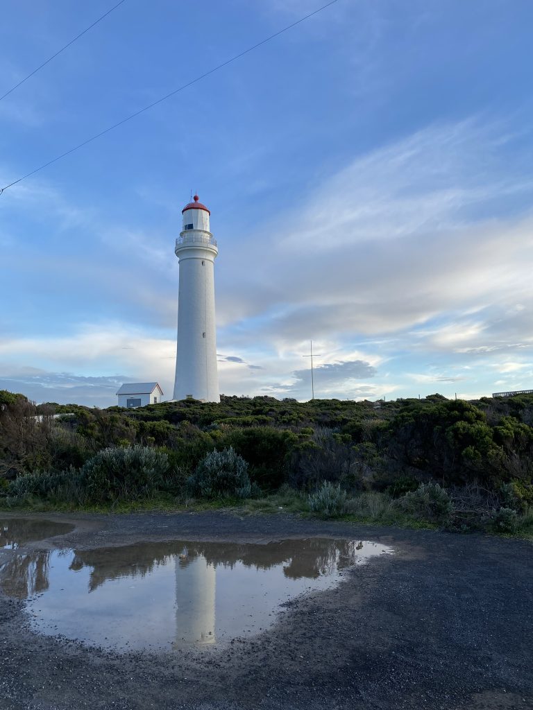
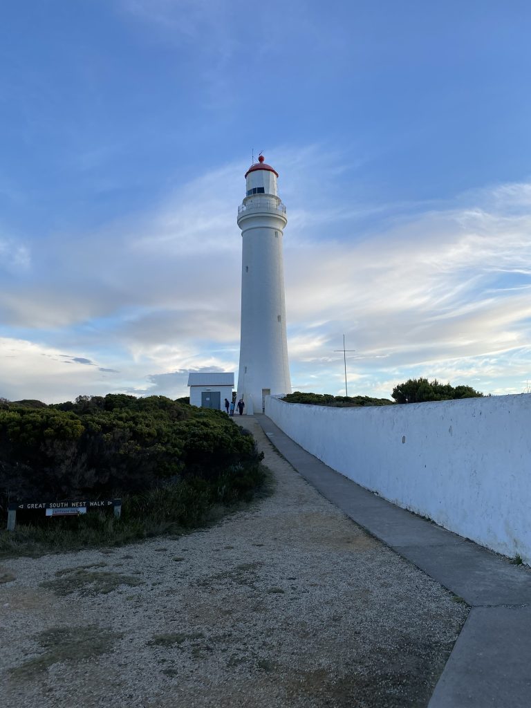
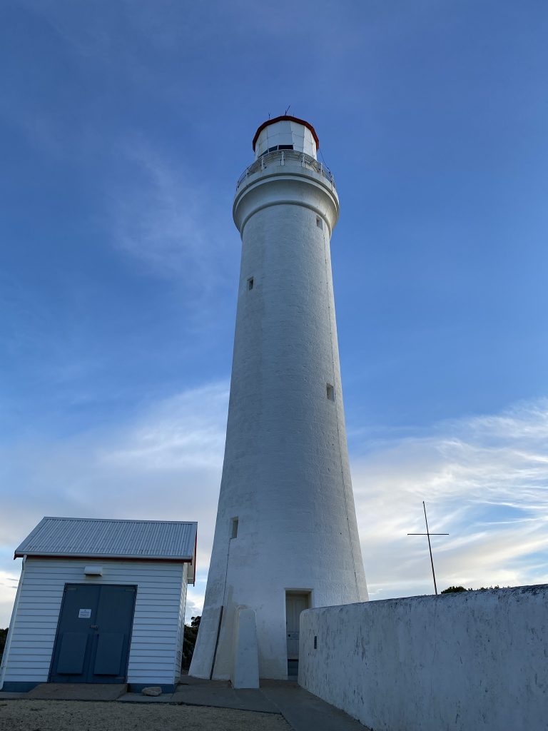
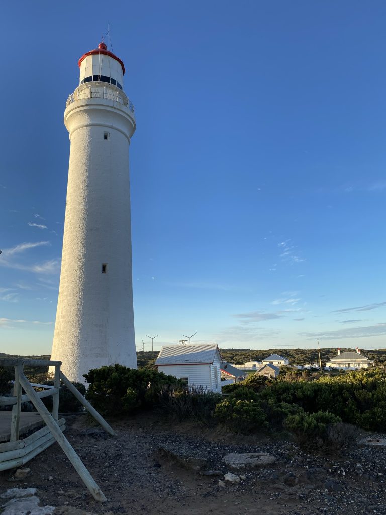
The lighthouse is 13 kilometres south of Portland, Victoria. The lighthouse grounds are open all year round. The white and red tower and the long stone wall are the features that give the Cape Nelson Lighthouse a whole character of its own.
The lighthouse was finally lit in 1884 after the building had been delayed by difficulty in obtaining suitable bluestone for the project. The need for a lighthouse west of Portland had been apparent since the earliest years of European settlement. The state of navigation, the nature of sailing vessels and the treacherous coastline meant that vessels were in danger as they made their way to and from Melbourne to Adelaide. From time to time there were major shipwrecks. In 1987 the light was connected to the main power and in the 1990s the lighthouse was “de-manned” or automated, ending an era of lighthouse keepers dating back to 1884.
